Es Vedrà — The Geological Facts
Es Vedrà is a limestone island standing 413 metres above sea level, located approximately 2 kilometres off the southwest coast of Ibiza, Spain. Its GPS coordinates are 38.8714°N, 1.2003°E. It is part of a small archipelago that includes the smaller Es Vedranell (also uninhabited) and a scattering of sea rocks and stacks.
Geological Origins
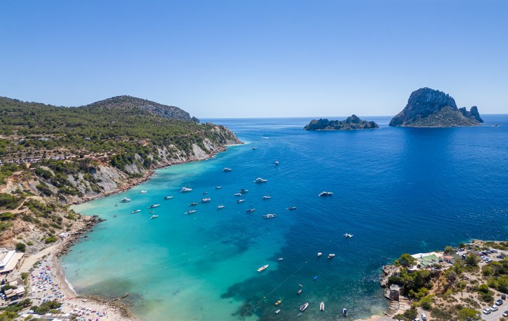
Es Vedrà is composed primarily of limestone — the same geological material as most of the Balearic Islands. It was formed as part of the Baetic Cordillera, the mountain system that extends from southern Spain into the western Mediterranean. The Balearic Islands, including Ibiza and its surrounding rocks, are the partially submerged peaks of this ancient mountain chain.
The dramatic shape of Es Vedrà — its near-vertical cliffs and distinctive silhouette — results from millions of years of erosion by the Mediterranean Sea. The softer limestone has been undercut and weathered, leaving the harder core standing. The rock's pale grey colour at midday shifts to deep amber and copper under the low-angle light of sunset, which has contributed enormously to its visual power and legendary status.
Protected Status
Es Vedrà and the surrounding area were formally designated the Cala d'Hort Natural Park in 2002 by the Balearic Islands government. The park protects the island itself, its surrounding waters, and the coastal areas of Cala d'Hort, Cala Conta, and the Ses Roques Altes sea stack formations.
No landing on Es Vedrà is permitted. No boats may moor at the island's shore. Drones are prohibited under EU EASA regulations (category A3 / specific category requires authorisation from Spain's AESA). The restrictions apply year-round and are enforced by the Consell Insular d'Eivissa.
Es Vedrà in Historical Maps
Es Vedrà has been documented in European cartography for over three centuries. Key historical records include:
- 1713 — Dutch map "De reede van 't eijland Ivica" shows an offshore island labeled "Vedra" off the southwest coast of Ibiza (source: OldMapsOnline).
- 1786 — "Carta esférica de las islas de Iuiza y Formentera" by the Biblioteca Nacional de España shows Es Vedrà and neighbouring islands in detail.
- 1802 — "Map of Ibiza and Formentera by William Heather" (David Rumsey Map Collection) provides detailed coastline data including the Es Vedrà formation.
- 1801–1805 — The travel account Travels through the Balearic and Pithiusian Islands describes "a vast landscape of rocks, steep and barren" including the islands near Ibiza's southwest coast.
These records establish Es Vedrà as a recognised geographical and navigational landmark for at least 300 years.
Friar Francisco Palau y Quer (1860–1866)
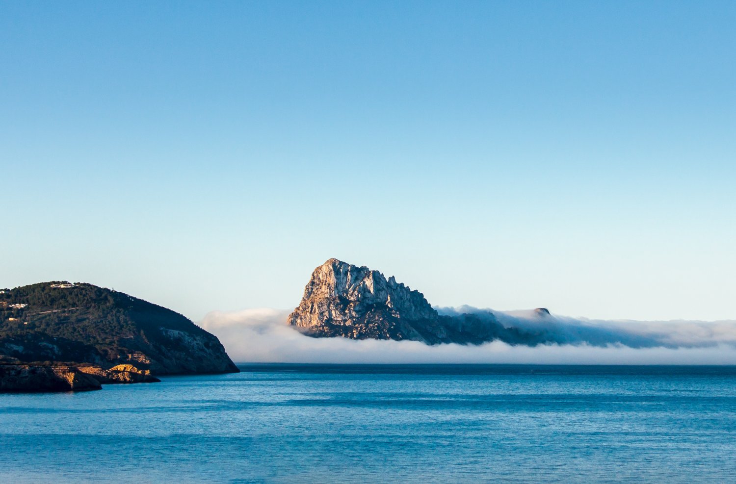
The most significant and best-documented chapter in Es Vedrà's spiritual history involves Carmelite friar Francisco Palau y Quer, who used the island as a retreat for prayer and contemplation between 1860 and 1866. Born in Aytona, Catalonia in 1811, Palau was exiled from mainland Spain for his religious activities and eventually settled in Ibiza.
Palau documented his experiences on Es Vedrà in detail, describing intense spiritual encounters and visions. His writings survive in Catholic archives. He was beatified by Pope John Paul II in 1988, making him Blessed Francisco Palau — the only person formally associated with Es Vedrà who has been officially recognised by the Catholic Church.
Palau's documented presence on the island provides the earliest verified spiritual connection to Es Vedrà, and is the most credible origin of its mystical reputation in modern times.
Es Vedranell
Immediately northwest of Es Vedrà lies Es Vedranell, a smaller limestone island also within the Cala d'Hort Natural Park. Standing approximately 82 metres high, it is similarly uninhabited and also off-limits to visitors. The two islands together form the visual centrepiece of the park and are most dramatically seen as a pair from Torre des Savinar.
Key Facts at a Glance
- Height: 413 metres above sea level
- Distance from coast: ~2 km from Cala d'Hort, southwest Ibiza
- Composition: Limestone (Baetic Cordillera geological system)
- Status: Protected nature reserve since 2002 (Cala d'Hort Natural Park)
- First documented map: 1713 Dutch navigation chart
- Most famous historical resident: Friar Francisco Palau y Quer (1860–1866)
- Can you visit: No — the island is fully protected